Sulfur dioxide (SO2) has a significant effect on global and regional climate by changing radiative forcing and contributes to acid deposition that damages aquatic and terrestrial ecosystems.
We have combined satellite-based emissions for large sources with a bottom-up inventory HTAP derived from reported fossil fuel combustion for smaller sources, to construct a new inventory OMI-HATP.
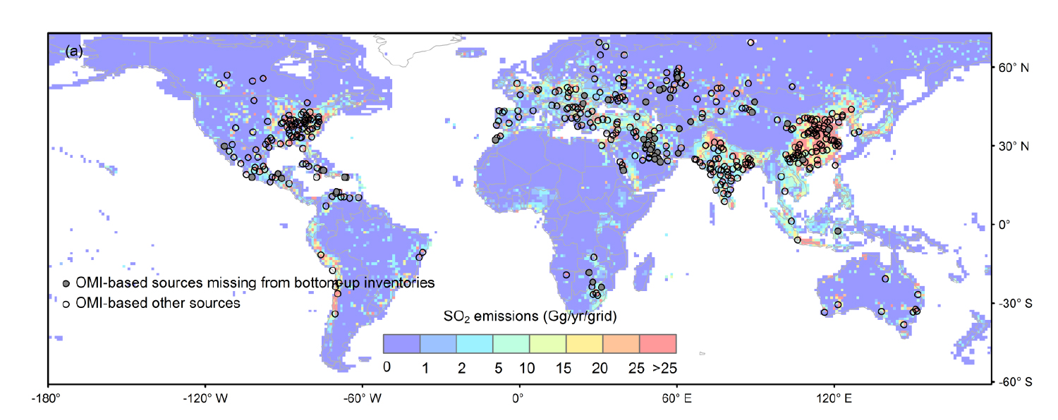
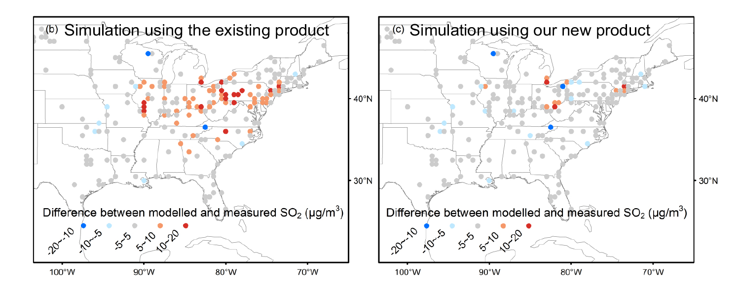
Above: (a) map of SO2 emissions in the OMI-HTAP inventory. (b) The differences of annual averaged SO2 surface concentrations between in-situ measurements and the modelled SO2 using the bottom-up inventory HTAP and (c) our new OMI-HTAP inventory.
Satellite-derived emission estimates are based on SO2 measurements from the Aura Ozone Monitoring Instrument (OMI). OMI is a Dutch–Finnish contribution to the NASA Aura mission.
This figure shows the spatial distribution of SO2 emissions in the OMI-HTAP inventory and the improved consistency of the modelled SO2 with measurements. The OMI-HTAP inventory provides monthly gridded SO2 emissions with global coverage at a spatial resolution of 0.1° × 0.1°. OMI-HTAP is available for the period from 2005 to 2017. The accuracy of OMI-HTAP has been evaluated by comparing modelled surface SO2 concentrations to the measurements from ground-based air-quality monitoring networks. Model simulations using OMI-HTAP show considerably better agreement with in situ measurements compared with those using the bottom-up inventory. The new emission database, OMI-HTAP, can be used on its own to capture the spatial and temporal variations in SO2 emissions. It can also be used to support climate and air quality modelling.
OMI-HTAP is novel in that it is the first inventory with inclusion of nearly 40 OMI-detected sources that are not captured in previous leading bottom-up inventories. It enables more accurate emission estimates for regions with such missing sources, e.g., the Middle East and Mexico. OMI-HTAP provides dynamic emissions for over 400 OMI-based large sources since 2005, allowing for updates to the emissions over time. OMI-HTAP with accurate location information of each large point source contributes to correction of the mislocated emissions in bottom-up inventories. The accuracy of the inventory can be substantially improved in the future using observations from the recently launched TROPOspheric Monitoring Instrument (TROPOMI) on the ESA Sentinel-5 Precursor satellite featuring even higher spatial resolution than OMI. More accurate estimates for diurnally and seasonally varying emissions can be expected using upcoming geostationary satellite instruments, e.g., NASA Tropospheric Emissions: Monitoring of Pollution (TEMPO), which will enable estimations for different times of the day.
References: Liu, F., Choi, S., Li, C., Fioletov, V. E., McLinden, C. A., Joiner, J., Krotkov, N. A., Bian, H., Janssens-Maenhout, G., Darmenov, A. S., and da Silva, A. M.: A new global anthropogenic SO2 emission inventory for the last decade: a mosaic of satellite-derived and bottom-up emissions, Atmos. Chem. Phys., 18, 16571-16586, https://doi.org/10.5194/acp-18-16571-2018, 2018..
04.2019

